Due to the Science Hall building renovation, the Robinson Map Library is temporarily located in the UW-Madison Computer Sciences Building – Rooms 2281 and 2310 .
More information can be found here.
Popular Resources
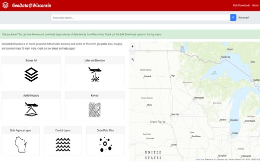
GeoData@Wisconsin
View and download publicly available state and local geospatial data, lidar, aerial imagery and scanned maps for Wisconsin.
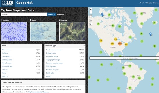
Big Ten Geoportal
Download geospatial data, scanned maps, and aerial imagery from Big Ten institutions (including UW-Madison).

Aerial Photography
The library is home to the largest collection of historic aerial photographs of Wisconsin, with over 260,000 images.
Library Hours & Information
Summer 2026
Aerial photo collection access by appointment:
July 6 – August 31: Monday-Wednesday
More information here.
Finding the Robinson Map Library:
We are temporarily located at:
1210 W. Dayton St. Madison, WI 53706
Room 2281 of Computer Sciences on the UW-Madison campus.
Download the Robinson Projection

PDF with graticule | PDF no graticule | JPEG with graticule | JPEG no graticule | Shapefile format